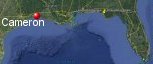
Cameron, Louisiana's History with Tropical Systems

(br) = Brush (ts) = Tropical Storm (bd) = Back Door, meaning coming from over land from opposite coast.
Not all names are noted. Also, storms before 1950 were not named. Not every stat on every storm description is given. (since 1871)

Years within or near core
1875bdtsbr
1879
1882
1886
1886m
1897
1898-2tsbr
1900brm
1905tsbr
1908tsbr
1909brm
1912tsbr
1915brm
1918m
1932brm
1934ts
1938
1940
1940ts
1941ts
1942br
1943br
1943tsbr
1946ts
1949tsbr
1957m
1957ts
1963br
1970ts
1971
1973tsbr
1974bdts
1978ts
1979ts
1980ts
1982ts
1985-2
1986
2002br
2004ts
2005m
2007br
2008ts
2008
2011ts
2017-2ts
2019tsbr
2020m
2020tsbr
2020
2021bdts
54 times in 153 years (as of end of 2024)


Names from list above (C storms most likely to impact the area)
Audrey
Bertha
Cindy
Edith
Felice
Edith
Carmen
Debra
Claudette
Danielle
Chris
Danny
Juan
Bonnie
Chantal
Lili
Ivan
Rita
Humberto
Edouard
Ike
Lee
Cindy
Harvey
Barry
Laura
Beta
Delta
Nicholas
Bertha
Cindy
Edith
Felice
Edith
Carmen
Debra
Claudette
Danielle
Chris
Danny
Juan
Bonnie
Chantal
Lili
Ivan
Rita
Humberto
Edouard
Ike
Lee
Cindy
Harvey
Barry
Laura
Beta
Delta
Nicholas
Tropical Storm to Hurricane ratio
TS = 28, 51.85%H = 26, 48.15%

Longest gap between storms
15 years 1987-2001How often this area gets affected?
brushed or hit on av every 2.83 yearsAverage years between direct hurricane hits. (hurricane force winds for at least a few hours)
Once every 9 years. (17 hits) State stats (older site)Average years between major hurricane hits.
Once every 30.6 years. (5 hits)Average MPH of hurricane hits. (based on sustained winds from advisories, not gusts)
104 mphStatistically when this area should be affected next
due in 2025Last affected by
2021 September 14th Tropical Storm Nicholas weakens to a TD while 67 miles to the west.This area's hurricane history
- 1879 August 23rd 105 mph just west while moving north. A 12 ft storm surge & many buildings destroyed.
- 1882 September 14th, 105 mph
- 1886 June 14th 95 mph from the southwest
- 1886 October 12th, 120 mph from the south, a 9 ft storm surge as winds blew for 36 hrs, most houses removed from foundations due to storm surge.196 killed & hundreds of cattle killed. Hit map
- 1897 September 13th 85 mph from the east-southeast
- 1918 August 6th, 120 mph from the south-southeast. It struck without warning. Pressure 28.36 inHg, gusts to 125 mph. Overall heavy damage 34 killed.
- 1938 August 14th, 75 mph from the south
- 1940 August 7th 80 mph from the east-southeast, 6 killed 5ft storm surge slow moving dumped 21 inches of rain
- 1957 Hurricane Audrey, 120 mph (HURDAT) from the south thousands of buildings destroyed June 27th. Between 90 and 95 percent of the buildings in Cameron and Lower Vermilion Parishes were damaged beyond repair. 13 foot storm surge decreased to 7.6 feet by the time it reached Lake Charles. Estimated 556 killed, 144 mph, over 40,000 homless in Louisiana. Pressure at landfall recorded at 959 mb, 28.30 inHg, with a forward speed of 14 mph, most winds at ground level were in the category 1 range. Surge animation | Newspaper article | Newspaper article #2
- 1971 September 16th, 90 mph Edith from the southwest gusts to 95 mph, 6 foot storm surge, 69 mph in Cameron with gusts to 96 mph passed approximately 30 miles east of Cameron. Heavy damage to sugarcane crops. NHC Wallet
- 1985 August 15th, Hurricane danny passes just east from the south with 90 mph winds. NHC Wallet
- 1985 October 28th, Hurricane Juan hits just southeast with 85 mph winds from the south before turning east. NHC Wallet
- 1986 June 26th Hurricane Bonnie, 85 mph from the south-southeast passes to the west. NHC Wallet
- 2005 September 24th Hurricane Rita hits with 120 mph winds from the south-southeast. High storm surge in many areas of Vermillion parish with very heavy damage.Moves slowly to the northwest as a large hurricane weakening while moving in. Hurricane warning show | Before and after Rita | Radar at landfall | Louisiana from space before & after Rita | Newspaper headline | Damage map | Models 2 days out
- 2008 September 13th Hurricane Ike passes to the southwest with 110 mph winds while moving into Galveston from the east-southeast. | Radar animation (Brian McNoldy, Univ. of Miami, Rosenstiel School) USGS surge info
- 2020 August 27th Hurricane Laura passes passes directly over with 150 mph winds while moving north pressure 938 mb. Radar animation (Brian McNoldy, Univ. of Miami, Rosenstiel School) | Radar shot as eye passes over | Our coverage as it happened | NHC storm surge info | Hit map | NHC report
- 2020 October 9th Hurricane Delta passes directly over with 105 mph winds while moving north-northeast. Radar animation (Brian McNoldy, Univ. of Miami, Rosenstiel School) | NHC report
Please keep these stats free. Donate to HurricaneCity.
.gif)
Stat sources:
Text Sources:
- "Divine Wind" by Kerry Emanuel
- "Florida Hurricanes and Tropical Storms" by John M. Williams and Iver W. Duedall
- "Florida's Hurricane History" by Jay Barnes
- "Hurricane Almanac" by Bryan Norcross
- HurricaneCity.com calculations by Jim Williams
- "Hurricanes and the Middle Atlantic States" by Rick Schwartz
- "Hurricane Watch" by Dr. Bob Sheets and Jack Williams
- "Inside the Hurricane" by Pete Davies
- "Isaac's Storm" by Erik Larson
- "Killer 'Cane" by Robert Mykle
- "Lunatic Wind" by William Price Fox
- Miami Herald newspaper (microfilm)
- "Path of Destruction" by John McQuaid and Mark Schleifstein
- Sun Sentinel newspaper (microfilm)
- "The Major Hurricanes To Affect The Bahamas" by Wayne Neely
- "The Ship and the Storm" by Jim Carrier
- Plus many more......