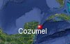
Cozumel, Mexico's History with Tropical Systems

(br) = Brush (ts) = Tropical Storm (bd) = Back Door, meaning coming from over land from opposite coast.
Not all names are noted. Also, storms before 1950 were not named. Not every stat on every storm description is given. (since 1871)

Years within or near core
1873
1877br
1879br
1880
1880ts
1881ts
1886tsbr
1887-2
1887tsbr
1889br
1893ts
1893
1895br
1895ts
1898ts
1903m
1905ts
1906br
1909
1911ts
1912ts
1913ts
1916br
1916tsbr
1918tsbr
1920ts
1922
1928tsbr
1933ts
1933
1934tsbr
1936ts
1938-2
1939ts
1942
1944-2
1947tsbr
1951m
1955
1961br
1967
1973tsbr
1975ts
1988m
1988ts
1995
1998tsbr
2003ts
2005-2m
2008ts
2009br
2011ts
2017tsbr
2020tsbr
2020ts
2020
2020
2021
2024
2024-2tsbr
65 times in 152 years (as of end of 2023)


Names from list above (C storms most likely to impact the area)
Charlie
Hilda
Carla
Beulah
Brenda
Eloise
Gilbert
Keith
Roxanne
Mitch
Claudette
Emily
Wilma
Dolly
Ida
Rina
Franklin
Cristobal
Gamma
Delta
Zeta
Grace
Beryl
Helene
Nadine
Hilda
Carla
Beulah
Brenda
Eloise
Gilbert
Keith
Roxanne
Mitch
Claudette
Emily
Wilma
Dolly
Ida
Rina
Franklin
Cristobal
Gamma
Delta
Zeta
Grace
Beryl
Helene
Nadine
Tropical Storm to Hurricane ratio
TS = 32, 49.23%H = 33, 50.77%

Longest gap between storms
12 years 1976-1987How often this area gets affected?
Brushed or hit every 2.35 yearsAverage years between direct hurricane hits. (hurricane force winds for at least a few hours)
Once every 6.12 years. (25 hits)Average years between major hurricane hits.
Once every 25.5 years. (6 hits)Average MPH of hurricane hits. (based on sustained winds from advisories, not gusts)
105 mphStatistically when this area should be affected next
Before the end of 2027
This is just a statistical average & does not mean the area will be affected by that year.
Last affected by
2024 October 19th Tropical Storm Nadine brushes well to the south by 188 miles at closest approach with 40 mph winds while moving west.This area's hurricane history
- 1873 October 1st a hurricane from the east with 90 mph winds move just northeast of here turning north
- 1880 August 9th 105 mph from the east-southeast hits just north
- 1887 95 mph July 25th from the south-southeast.
- 1887 September 17th 95 mph from the southeast.
- 1893 September 28th 95 mph from the southeast.
- 1903, 120 mph August 13th from the east-southeast.
- 1909 August 25th, 105 mph just north from the east
- 1922 October 18th, 85 mph from the east.
- 1933 a category 2 105 mph hits September 22nd from the east-southeast
- 1938, 95 mph August13th from the southeast just north.
- 1938 August 25th 95 mph from the east-southeast just south from the east-southeast.
- 1942 August 27th, 105 mph from the southeast just north.
- 1944 a category 1 90 mph hits August 22nd from the east-southeast.
- 1944 80 mph September 20th from the east.
- 1951 Hurricane Charlie hits with 130 mph winds August 19th from the east-southeast.
- 1955 September 16th, Hurricane Hilda passes to the south with 110 mph winds from the east-southeast
- 1967 Beulah hits as a category 2, 110 mph on September 16th from the east-southeast
- 1988 September 14th, 165 mph from the east-southeast during Hurricane Gilbert 52 were killed towns were destroyed by a 17ft storm surge, ruins only had minor damage. Satelite photo
- 1995 October 10th, Hurricane Roxanne hits with 110 mph winds pressure 28.29 from the east.
- 2005 July 18th 130 mph Hurricane Emily hits as a category 4 from the east-southeast, although surface winds were much less. Sporadic damage to buildings in & around Cozumel, Mexico. Damage shot from Playa del carmen on mainland #1 | #2 | #3 | Animated radar at landfall | Our coverage of Emily
- 2005, October 21st, Hurricane Wilma passes over the Island while moving slowly north-northwest. Extensive damage to nearly the entire island.At this time Wilma had winds of 140 mph & was moving very slowly at less than 5 mph.Hurricane force winds pounded the island for over 24hrs. As of early 2006 many hotels are still shut down & the cruise ships docks have been destroyed. Hurricane warning show | Satellite image of Wilma as a category 5 before landfall, strongest ever in the Atlantic basin as of 2005. | Animated radar (Brian McNoldy, Univ. of Miami, Rosenstiel School)" target="_blank">Animated radar | Aftermath video from Cozumel
- 2020 October 7th Hurricane Delta southern eye wall hits northern Cozumel with 105 mph winds. Hit map
- 2020 October 26th Hurricane Zeta eye passes just south of the island while moving northwest with 80 mph winds. Hit map
- 2021 August 19th Hurricane Grace comes ashore just south with 80 mph winds southern half of island highest winds. Hit map | NHC Report
- 2024 July 5th Hurricane Beryl eye passes just south of Cozumel with 110 mph winds most of island feels hurricane force winds. Hit map | Satellite animation
Please keep these stats free. Donate to HurricaneCity.
.gif)
Stat sources:
Text Sources:
- "Divine Wind" by Kerry Emanuel
- "Florida Hurricanes and Tropical Storms" by John M. Williams and Iver W. Duedall
- "Florida's Hurricane History" by Jay Barnes
- "Hurricane Almanac" by Bryan Norcross
- HurricaneCity.com calculations by Jim Williams
- "Hurricanes and the Middle Atlantic States" by Rick Schwartz
- "Hurricane Watch" by Dr. Bob Sheets and Jack Williams
- "Inside the Hurricane" by Pete Davies
- "Isaac's Storm" by Erik Larson
- "Killer 'Cane" by Robert Mykle
- "Lunatic Wind" by William Price Fox
- Miami Herald newspaper (microfilm)
- "Path of Destruction" by John McQuaid and Mark Schleifstein
- Sun Sentinel newspaper (microfilm)
- "The Major Hurricanes To Affect The Bahamas" by Wayne Neely
- "The Ship and the Storm" by Jim Carrier
- Plus many more......