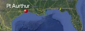
Port Arthur, Texas History with Tropical Systems
(br) = Brush (ts) = Tropical Storm (bd) = Back Door, meaning coming from over land from opposite coast.
Not all names are noted. Also, storms before 1950 were not named. Not every stat on every storm description is given. (since 1871)

Years within 60 miles
1871-2tsbr
1875bdts
1879
1882
1886
1886m
1891tsbr
1897
1898tsbr
1898ts
1900m
1909brm
1915brm
1918m
1932m
1934ts
1938br
1940
1940ts
1941ts
1941tsbr
1942br
1943
1946ts
1947br
1949br
1957m
1957ts
1959tsbr
1963ts (HURDAT)
1970ts
1971br
1973tsbr
1978ts
1979ts
1980tsbr
1982ts
1983brm
1985tsbr
1985br
1986
1987ts
1989tsbr
2001tsbr
2005m
2007
2008ts
2008
2017tsbr
2017ts
2020m
2020tsbr
2020br
2021bdts
2024tsbr
56 times in 153 years (as of end of 2024)


Names from list above (D storms most likely to impact the area)
Audrey
Debra
Cindy
Edith
Delia
Debra
Claudette
Danielle
Chris
Alicia
Danny
Juan
Bonnie
Chantal
Jerry
Rita
Humberto
Edouard
Ike
Cindy
Harvey
Barry
Laura
Beta
Delta
Nicholas
Beryl
Debra
Cindy
Edith
Delia
Debra
Claudette
Danielle
Chris
Alicia
Danny
Juan
Bonnie
Chantal
Jerry
Rita
Humberto
Edouard
Ike
Cindy
Harvey
Barry
Laura
Beta
Delta
Nicholas
Beryl
Tropical Storm to Hurricane ratio
TS = 30, 53.57%H = 26, 46.43%

Longest gap between storms
13 years 1919-1931How often this area gets affected?
Brushed or hit every 2.73 yearsAverage years between direct hurricane hits. (usually within 40 miles to include small hurricanes)
Once every 9 years. (17 hits) State stats (older site)Average years between major hurricane hits.
Once every 21.86 years. (7 hits)Average MPH of hurricane hits. (based on sustained winds from advisories, not gusts)
107 mphStatistically when this area should be affected next
Before the end of 2027
This is just a statistical average & does not mean the area will be affected by that year.
Last affected by
2024 July 8th Tropical Storm Beryl brushes well to the west while moving north with 60 mph winds.This area's hurricane history
- 1879, 105 mph winds from the south August 22nd
- 1882 September 15th, 105 mph from the east-southeast.
- 1886 June 14th, 95 mph from the south-southwest.
- 1886 October 12th, 120 mph just east from the south hurricane force winds for 36 hours. Hit map
- 1897 September 13th 85 mph, kills 13. Many houses in Port Arthur destroyed.
- 1900 September 8th 150 mph winds to the south hitting Galveston from the east-southeast.
- 1918 August 6th 120 mph winds from the southeast just east.
- 1932 August 13th, 150 mph to the south while hitting Galveston from the south-southeast.
- 1940 August 7th 80 mph hurricane hits from the southeast winds with hurricane force winds extending out only 20 miles.
- 1943 July 27th, 85 mph from the east-southeast just south.
- 1957 June 27th Hurricane Audrey hits from the south just east with 120 mph winds (HURDAT) moving north. 17,000 left homeless. Pressure recorded at landfall was 966 mb, 28.51 inHg. Newspaper article | Newspaper article #2
- 1986 June 26th Bonnie hit from the southeast with 80 mph winds moderate damage 3 killed. NHC Wallet
- 2005 September 24th Hurricane Rita hits with 120 mph winds just east. Moderate damage & surge as east side of Rita passed by to the east.Moves slowly to the northwest as a large hurricane weakening while moving in.Officially winds reached 116 mph in Port Arthur. Radar animation (Brian McNoldy, Univ. of Miami, Rosenstiel School) Hurricane warning show | Radar still at landfall | Damage map | Damage shot | Models 2 days out
- 2007 September 13th Hurricane Humberto hits with 85 mph. Became a Hurricane quickly while moving north-northeast heading inland & caused moderate damage to the area.The highest official wind report was from CMAN station at sea rim pk with a 10min av wind speed of 70 mph with gusts to 84 mph. An unofficial gust of 101kt was recieved from a barge located in the golden Pass ship channel near the Texas/Louisiana border. Strengthened from 25kts to 80kt within 24 hrs while to the south. Est 986 mb before landfall and 988 mb at the Beaumont/Port Arthur airport. Highest storm tide was 4.87ft from the Texas point guage. 1 death reported in the area, 120,000 without power. Radar animation (Brian McNoldy, Univ. of Miami, Rosenstiel School)
- 2008 Hurricane Ike hits 65 miles to the south on September 13th with 110 mph winds this massive hurricane gave Port Arthur hurricane force gusts & a very high storm surge flooding many areas.Port Arthur, located several miles inland at the head of Sabine Lake, measured a maximum surge of 11.03 ft.Gusts recorded at 83 mph Radar animation (Brian McNoldy, Univ. of Miami, Rosenstiel School) Ike model history | Surge animation | Our coverage as it happened
- 2017 August 30th Tropical Storm Harvey moves inland just east of here by 23 miles with 45 mph winds dumping heavy rain. Gusts here to 43 mph storm surge 4.2ft 47.99 inches of rain, 5 deaths in Jefferson County. Just inland in Beaumont up to 49 inches of rain in and around area. NHC final report
- 2020 August 27th Hurricane Laura passes 32 miles to the east at closest approach with 140 mph winds area experiences winds less than major strength but many tress fell. Pressure in Port Arthur 985 mb. Winds mostly out of northeast and north at time of worst conditions while Laura was moving north. Radar animation (Brian McNoldy, Univ. of Miami, Rosenstiel School) hit map | NHC report
Please keep these stats free. Donate to HurricaneCity.
.gif)
Stat sources:
Text Sources:
- "Divine Wind" by Kerry Emanuel
- "Florida Hurricanes and Tropical Storms" by John M. Williams and Iver W. Duedall
- "Florida's Hurricane History" by Jay Barnes
- "Hurricane Almanac" by Bryan Norcross
- HurricaneCity.com calculations by Jim Williams
- "Hurricanes and the Middle Atlantic States" by Rick Schwartz
- "Hurricane Watch" by Dr. Bob Sheets and Jack Williams
- "Inside the Hurricane" by Pete Davies
- "Isaac's Storm" by Erik Larson
- "Killer 'Cane" by Robert Mykle
- "Lunatic Wind" by William Price Fox
- Miami Herald newspaper (microfilm)
- "Path of Destruction" by John McQuaid and Mark Schleifstein
- Sun Sentinel newspaper (microfilm)
- "The Major Hurricanes To Affect The Bahamas" by Wayne Neely
- "The Ship and the Storm" by Jim Carrier
- Plus many more......