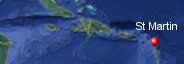
Saint Martin & Sint Maarten's History with Tropical Systems


(br) = Brush (ts) = Tropical Storm (bd) = Back Door, meaning coming from over land from opposite coast.
Not all names are noted. Also, storms before 1950 were not named. Not every stat on every storm description is given. (since 1871)

Years within or near core
1871m
1872ts
1876
1878ts
1881ts
1889
1889ts
1891tsbr
1893br
1898
1898ts
1899brm
1899m
1900tsbr
1901ts
1906
1908
1908tsbr
1910br
1916
1922m
1924
1928brm
1931
1932m
1933-2ts
1938ts
1943ts
1947ts
1949tsbr
1950tsbr
1950m
1953ts
1960m
1966
1979-2ts
1989brm
1990tsbr
1995br
1995m
1996
1998
1999
1999m
2000
2008brm
2010
2011-2ts
2014
2017m
2017-2brm
2020ts
2022tsbr
2023ts
2023br
2024ts
60 times in 153 years (as of end of 2024)


Names from list above (F storms most likely to impact the area). (R) = Retired
Baker
Dog
Edna(r)
Donna(r)
Faith
Claudette
Frederic(r)
Hugo(r)
Klaus(r)
Luis(r)
Marilyn(r)
Bertha
Georges(r)
Jose
Lenny(r)
Debby
Omar
Earl
Irene
Maria
Gonzalo
Irma
Jose
Maria(r)
Laura(r)
Fiona(r)
Philippe
Tammy
Ernesto
Dog
Edna(r)
Donna(r)
Faith
Claudette
Frederic(r)
Hugo(r)
Klaus(r)
Luis(r)
Marilyn(r)
Bertha
Georges(r)
Jose
Lenny(r)
Debby
Omar
Earl
Irene
Maria
Gonzalo
Irma
Jose
Maria(r)
Laura(r)
Fiona(r)
Philippe
Tammy
Ernesto
Tropical Storm to Hurricane ratio
TS = 26, 43.33%H = 34, 56.67%

Longest gap between storms
12 years 1966-1979How often this area gets affected?
Brushed or hit every 2.55 yearsAverage years between direct hurricane hits.
Once every 6.38 years. (24 hits)Average years between major hurricane hits.
Once every 17 years. (9 hits)Average MPH of hurricane hits. (based on sustained winds from advisories, not gusts)
108 mphStatistically when this area should be affected next
Before the end of 2027
This is just a statistical average & does not mean the area will be affected by that year.
Last affected by
2024 August 13th Tropical Storm Ernesto passes just south by 43 miles with 60 mph winds moving west-northwest.This area's hurricane history
- 1871 August 21st a Hurricane hits with 115 mph winds while moving west-northwest. Hit map
- 1876 September 12th, 110 mph from the east.
- 1889 September 3rd 95 mph from the east-southeast just south.
- 1898 September 12, 110 mph winds from the south.
- 1899 September 8th, 115 mph from the east-southeast just north. Hit map
- 1906 September 2nd, 105 mph from the southeast
- 1908 March 7th, 95 mph from the north-northeast passes just east
- 1916 August 21st, 85 mph from the east-southeast.
- 1922 September 16th 115 mph (HURDAT) from the southeast. Hit map
- 1924 August 28th 80 mph from the east-southeast.
- 1931 September 10th, 80 mph from the east.
- 1932 September 26th 115 mph from the east. Hit map
- 1950 Hurricane Dog September 1st, 125 mph from the southeast. Hit map
- 1960 Hurricane Donna September 5th winds 150 mph from the east-southeast, 7 killed very heavy damage on the island.
- 1966 August 26th Hurricane Faith hits with 90 mph winds from the east-southeast
- 1995 Hurricane Luis September 5th, 125 mph winds badly hit the area leaving 1,000 homeless 14 killed gusts to 140 mph winds pressure 27.61. Average model error
- 1996 Hurricane Bertha hits with 80 mph winds July 8th from the east-southeast causing some roof damage. Pressure 29.08 inHg. City of Grand Case lost most buildings on northeast corner of island.
- 1998 September 21st Hurricane Georges to the south with 110 mph winds from the east-southeast.
- 1999 October 21st Hurricane Jose hits with 95 mph winds from the southeast pressure 29.23 minor damage reported due to the fact that Jose was in a weakening mode many trees down minor roof damage. Preliminary report NHC
- 1999 November 18th Hurricane Lenny pounds the island with 130 mph winds from the west-southwest as Lenny sat over the island in a weakening mode for 24 hrs before moving on.South facing beaches took a beating.13 killed here & now insurers on the island are either cancelling policies & drastically raising rates due to 5 hurricanes in 7 years.Tourism is pretty much shut down for the winter on the island as a result of Hurricane Lenny. Damage reports from StormCarib | Preliminary report NHC
- 2000 August 22nd Hurricane Debby hits with 75 mph winds from the east-southeast causing minor damage here.
- 2010 Hurricane earl hits just north with 110 mph winds August 30th from the east-southeast.While heavy seas and seaweed were blamed as major factors in the disruption of electricity generation as a result of the passing of the storm, tons of seaweed washed ashore by the storm were also in evidence on the Great Bay beach promenade and at Captain Hodge Wharf. Several trucks were used Thursday to cart away the seaweed and other debris. Radar animation
- 2014 Hurricane Gonzalo hits with 85 mph winds from the east-southeast on October 13th. 1 killed 87 yr old man riding out hurricane in a boat.37 boats destroyed but over minor damage to infrustructure. The island reported 5.70 inches of rain 994.1 mb. Position when hit | Radar animation (Brian McNoldy, Univ. of Miami, Rosenstiel School) | NHC final report (pdf)
- 2017 Hurricane Irma eye passes directly over with 185 mph winds on September 6th causing very heavy destruction.95% destroyed", according to Daniel Gibb, a local official, who called it "an enormous catastrophe": 4 killed 50 injured as of 9/7. Before & after photos | Best track data | Our live coverage | Radar animation (Brian McNoldy, Univ. of Miami, Rosenstiel School) | Amazing video of wind
Please keep these stats free. Donate to HurricaneCity.
.gif)
Stat sources:
Text Sources:
- "Divine Wind" by Kerry Emanuel
- "Florida Hurricanes and Tropical Storms" by John M. Williams and Iver W. Duedall
- "Florida's Hurricane History" by Jay Barnes
- "Hurricane Almanac" by Bryan Norcross
- HurricaneCity.com calculations by Jim Williams
- "Hurricanes and the Middle Atlantic States" by Rick Schwartz
- "Hurricane Watch" by Dr. Bob Sheets and Jack Williams
- "Inside the Hurricane" by Pete Davies
- "Isaac's Storm" by Erik Larson
- "Killer 'Cane" by Robert Mykle
- "Lunatic Wind" by William Price Fox
- Miami Herald newspaper (microfilm)
- "Path of Destruction" by John McQuaid and Mark Schleifstein
- Sun Sentinel newspaper (microfilm)
- "The Major Hurricanes To Affect The Bahamas" by Wayne Neely
- "The Ship and the Storm" by Jim Carrier
- Plus many more......