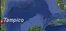
Tampico, Mexico's History with Tropical Systems

(br) = Brush (ts) = Tropical Storm (bd) = Back Door, meaning coming from over land from opposite coast.
Not all names are noted. Also, storms before 1950 were not named. Not every stat on every storm description is given. (since 1871)

Years within or near core
1878br
1892tsbr
1903br
1921
1931ts
1933tsbr
1933ts
1933-2
1934ts
1938tsbr
1946ts
1947m
1951m
1955ts
1955m
1956
1956tsbr
1959ts
1966m
1967
1988br
1990br
1993br
1996
2000
2005ts
2011ts
2014ts
2021br
2024ts
1892tsbr
1903br
1921
1931ts
1933tsbr
1933ts
1933-2
1934ts
1938tsbr
1946ts
1947m
1951m
1955ts
1955m
1956
1956tsbr
1959ts
1966m
1967
1988br
1990br
1993br
1996
2000
2005ts
2011ts
2014ts
2021br
2024ts
31 times in 153 years (as of end of 2024)


Names from list above (G storms most likely to impact the area)
Charlie
Gladys
Hilda
Anna
Dora
Beulah
Inez
Fern
Gilbert
Diana
Gert
Dolly
Keith
Gert
Arlene
Dolly
Grace
Alberto
Gladys
Hilda
Anna
Dora
Beulah
Inez
Fern
Gilbert
Diana
Gert
Dolly
Keith
Gert
Arlene
Dolly
Grace
Alberto
Tropical Storm to Hurricane ratio
TS = 14, 45.16%H = 17, 54.84%

Longest gap between storms
20 years 1967-1988How often this area gets affected?
Brushed or hit every 4.94 yearsAverage years between direct hurricane hits. (hurricane force winds for a few hours)
Once every 13.91 years. (11 hits)Average years between major hurricane hits.
Once every 38.25 years. (4 hits)Average MPH of hurricane hits. (based on sustained winds from advisories, not gusts)
93 mphStatistically when this area should be affected next
Before the end of 2029
This is just a statistical average & does not mean the area will be affected by that year.
Last affected by
2024 June 20th Tropical storm Alberto passes over with 50 mph winds from the east.This area's hurricane history
- 1921 September 7th, 80 mph from the east-southeast
- 1933 September 15th, from the east 75 mph.
- 1933 September 24th, 75 mph from the east, hundreds die from flooding
- 1947 August 15th, 115 mph (HURDAT) from the east. 1 death in Tampico & 18 others to the south.
- 1951 August 22nd, Hurricane Charlie hits with 115 mph winds (HURDAT) from the east
- 1955 September 19th, Hurricane Hilda hits with 120 mph winds (HURDAT) from the east-southeast causing bad damage & heavy flooding.200 killed, half of city underwater.Panuco river highest level in 30 years.
- 1956 July 26th, Hurricane Ana hits just south with 80 mph winds from the east-southeast pressure 29.26
- 1966 October 10th Hurricane Inez hits with 120 mph winds from the east gusts to 127 mph caused a 12 ft storm surge & kills 65. NHC Wallet
- 1967 October 4th, Hurricane Fern hits from the east with 75 mph winds. NHC Wallet
- 1996 August 23rd, Hurricane Dolly hits with 80 mph winds pressure 29.15 just south from the east-southeast dumping heavy rain 2 killed 42 injured 100s of homes flooded. NHC report
- 2000, October 5th Hurricane Keith hits 20 miles to the north with 90 mph winds from the east-southeast dumping heavy rains, 75 mph winds reported in tampico. An elderly man was electrocuted in the city of Tampico in Mexico's northeastern state of Tamaulipas when he touched a live cable that had been blown down in his garden. Keith caused moderate damage as it left traffic signs damaged, some trees partially uprooted and billboards damaged. NHC Report
Please keep these stats free. Donate to HurricaneCity.
.gif)
Stat sources:
Text Sources:
- "Divine Wind" by Kerry Emanuel
- "Florida Hurricanes and Tropical Storms" by John M. Williams and Iver W. Duedall
- "Florida's Hurricane History" by Jay Barnes
- "Hurricane Almanac" by Bryan Norcross
- HurricaneCity.com calculations by Jim Williams
- "Hurricanes and the Middle Atlantic States" by Rick Schwartz
- "Hurricane Watch" by Dr. Bob Sheets and Jack Williams
- "Inside the Hurricane" by Pete Davies
- "Isaac's Storm" by Erik Larson
- "Killer 'Cane" by Robert Mykle
- "Lunatic Wind" by William Price Fox
- Miami Herald newspaper (microfilm)
- "Path of Destruction" by John McQuaid and Mark Schleifstein
- Sun Sentinel newspaper (microfilm)
- "The Major Hurricanes To Affect The Bahamas" by Wayne Neely
- "The Ship and the Storm" by Jim Carrier
- Plus many more......